Aug 11, 2010

Adventures in the Northern Wet

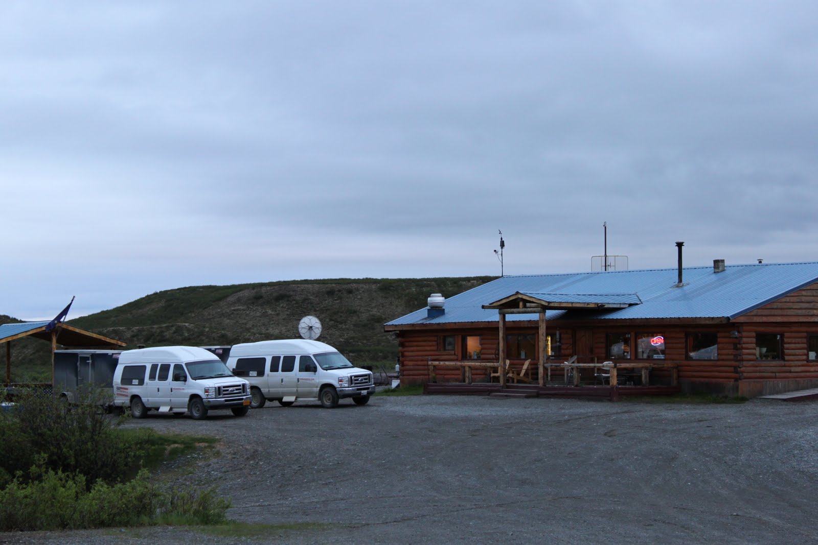
Most people who romanticize about sleeping in tents don't do it very often. Each year I average 150 bag nights, in a tent, somewhere. Leading camping tours from April to November, from the deserts of the Southwest to the Rocky Mountains to Alaska and the Yukon, I've seen a lot of weather. On Key West my tent became a stifling greenhouse and I had to sleep outside on the sand. Overlooking the Mackenzie River in the Northwest Territories, I woke to a survival situation at 3 am as a sudden windstorm threatened to blast our tents off the knoll. Nothing quite like running around in the middle of the night, arctic sun still up, frantically hammering down ropes. In West Glacier, Montana, a September morning revealed soaked tents, sodden, collapsed cook canopies and expressions of grim doubt. Last summer in Seward, Alaska, our campground turned into a frigid, muddy lake overnight. While my passengers were out watching killer whales in the fjords, I was mopping out tents and digging drainage canals.

Last summer in Alaska I saw a lot of rain. It felt wet, but when camping and living out of doors, all weather becomes a richer, more intimate experience. After several days of cold rain and mud, a two-hour break of sun can feel like a two-week Caribbean vacation. By the end of last summer, after three months of leading trips in Alaska, I was saying things like "One clear day is worth three rainy days" and "The only bad weather is weather that keeps us from doing what we want." Which is actually true. And besides - if you're in a kayak, on the water, paddling through brash ice, socked in by cloud, who cares if it's raining?

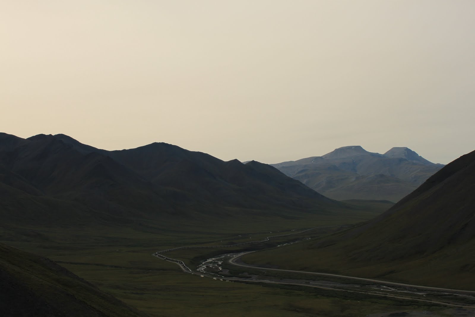
Water, in various forms, is one of the most dynamic and salient aspects of the Alaskan landscape. Clouds, glaciers, rivers, harbors, bays and sounds, the ocean, rain, fog, snow, ice - they're all on display in The Last Frontier. Never passive, water only caused me real trouble when key roads were washed out in flash floods in the Yukon and eastern Alaska. In one case this was a blessing in disguise, as I had no choice but to reroute a tour from the Yukon to the Alaskan Arctic, seeing some amazing landscapes I wouldn't have otherwise. Here are a few photos and words from up north.

Resurrection Bay and Seward Harbor

From the journal:

6/30/10 Destruction Bay, Yukon
". . .woke up in Tok to the first sun in five days. Everyone was cheerful and stripped down to t-shirts. By 10:30 it was cloudy again. . . as I write this in my tent it's coming down. Everything is wet and dirty. No mountains visible anywhere due to cloud cover. And nothing to do tomorrow but hike or sit. . . it has to break sometime, doesn't it?"

6/14/10 Seward, AK
"Lying in a broken, shitty tent with water coming in. Been raining all day and doesn't look like stopping. Mud and puddles everywhere. Quiet mood. Wet tents. The hike to Harding Icefield tomorrow will be tough if it doesn't let up. . . what else can we do in Seward?"

7/25/10
"Alaska is teaching me to enjoy every nice day."

7/31/10 Fairbanks, AK
". . . drove to Whitehorse anyway. Found out that afternoon that they'd repaired the Dempster Highway washouts and gotten one lane open again. Changed everything again - calling, booking, canceling, booking again, getting on the phone with the DOT. After a beautiful seven-hour drive north to Dawson City, the first thing we saw in town was a sign saying the Dempster had been washed out again. . . the Taylor highway (only other way out of town) had been washed out but was supposed to open Friday morning. . . we made it through to Chicken and then hauled ass to Fairbanks. Later found out someone hit the Lakaina River bridge on the McCarthy Road and it's temporarily closed."

8/28/10 Anchorage
"Last time at Denali on tour. . . woke to rain and didn't feel like getting out of my sleeping bag. Also very hungover. . . Spent the lunch stop crawling around in the water, changing the van tire."

Iceberg kayak at the Columbia Glacier

Full moon over Kluane Lake, Yukon Territory

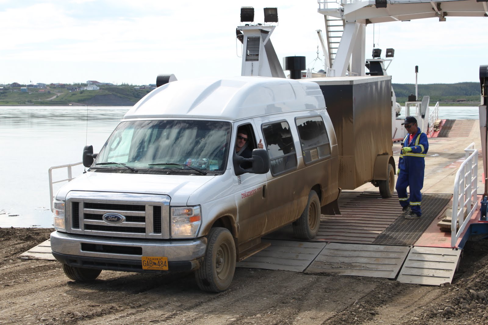
Crossing the Mackenzie River, Northwest Territories

Mount McKinley and the Susitna River

Coming soon. . . stories about good weather.

Wrangell - St Elias


A national park as big as Switzerland with higher mountains. A mind-bending mountain kingdom where four ranges converge, full of glaciers, old volcanoes, bears and copper mines. Only two spur roads actually enter Wrangell - St Elias, the Nabesna Road and the McCarthy Road, built atop an old railroad grade. After the richest copper strike in US history in the Kennecott Valley in 1900, an almost impossible railroad was built to transport the ore hundreds of miles to Cordova, the nearest port on Prince William Sound. After the copper ran out and the mines were closed in 1938, the towns of Kennecott and nearby McCarthy were all but abandoned and the tracks ripped up. The grade was donated to the state and the legendary McCarthy Road was born. Starting in Chitina on the Copper River, it's 60 miles of rough dirt to the end of the road at the Kennicott River (and the footbridge that takes you to McCarthy.)

I've seen plenty of moose, four or five black bears and a few coyotes on the road, having just driven it for the fourth time. Not as bad as it used to be (according to the locals) but with every grading old railroad spikes still emerge. The town of Kennecott has a museum feel since the NPS bought most of the old mine buildings and restored them. But tiny McCarthy (or 'the center of the universe' according to some of the ice guides) still comes to life every night when the bar opens. Every time I bring a group here, I tell them to count the beards and they usually give up around thirty. A lot of characters for a few old wooden buildings hunched along a muddy street.

Gilahina Trestle crumbles quietly along the McCarthy Road

The road ends at the footbridge and the world's most scenic parking lot. In the background is the 7,000 foot Stairway Icefall


Downtown McCarthy
Looking down into a moulin (a water-bored hole in the ice)
Climbing on Root Glacier
One of the world's biggest icefalls, the Stairway drops over a vertical mile into the Root Glacier

Alaska Range

Maclaren Glacier creeping under low clouds
Flying over talus and tarn in Denali National Park
Landing at Healy
Looking north from mile 14 on the Denali Highway
Polychrome Mountains in Denali
Gulkana Glacier from the Richardson Highway
Mount Hayes and friends from the top of Donnelly Dome

Aug 9, 2010

Dalton Highway and the Brooks Range

Cruising the pipeline

Still known locally as the Haul Road, the Dalton was built along with the Trans-Alaska Pipeline in the 1970s. Just over 400 miles of mostly gravel runs from north of Fairbanks up to Deadhorse and the oilfields of the North Slope, crossing the Yukon River, Arctic Circle and the Brooks Range along the way. Like the Dempster Highway in the Yukon Territory, this road wasn't built for a Sunday drive. An hour can pass without seeing another vehicle. Two headlights and a dust cloud on the horizon become a mud-crusted big rig pulling two trailers, hurling gravel, hauling ass across the tundra. Most of the other pickups on the road belong to oilfield workers or to Alyeska, the company that owns and operates the pipeline. After crossing the Yukon, the Dalton snakes through bogs, bridges several rivers, passes a few million stunted black spruce and crosses the Arctic Circle at 66 degrees north. Not long afterward the jagged, austere Brooks Range rises on the horizon. The most northerly mountains on the continent, these ancient peaks rise like islands above the tundra. The silence is sobering. Dall sheep stand sentinel high on the rocky slopes.

River valleys full of wolf and grizzly tracks rise through willow-choked banks to low hills covered with blueberry and low-bush cranberry.The tundra here is staggering in its variety, with one square foot containing stiff, mint-green lichen, mosses of deep green, crimson and pale yellow and four or five different mushrooms moistened by recent rains. Above the tree line, the mountains are breaking apart,
streaming scree slopes into the valleys below. It's a special and stilling place.

My group camped at Marion Creek for two nights, one of the Bureau of Land Management campgrounds along the highway and just north of Coldfoot. On the second day we drove up to Atigun Pass (at 4,800 feet the highest road pass in Alaska.) Then we hiked east along Nutirwik Creek, a braided river wandering in channels across the gravelly valley floor, past animal tracks and up into the hills for views and blueberries. Then an arctic bath as I stripped down and splashed off in Marion Creek.

Road, river and pipeline in the Brooks Range

My office at Marion Creek
Ursus arctos was here

The mosquito killer
Hitching into the Brooks


Atigun Pass in the Brooks Range

Jul 18, 2010

Alaska/Yukon Highlights

Dall sheep on the park road in Denali

The Seaview Cafe and Bar in downtown Hope, Alaska. I camped across the street as usual. Later that night the deck caved in while a band was jamming out.


This is a video of me drinking my second Sourtoe Cocktail, a Dawson City institution from way back. A mummified human toe is placed in a glass of liquor and downed, with the stipulation that the toe touch the drinker's lips. . . although some take it a step farther.

Night settles on the Maclaren River Lodge, Denali Highway

Coming in for a landing on the Ruth Glacier, Mt McKinley

Toklat River, Alaska Range

Parking lot cornhole with Tim in Girdwood

The Dempster Highway

The Dempster Highway snakes into the Northwest Territories

Leaving Dawson City, I had no idea what I was in for. . .

The Dempster Highway is a 457-mile dirt road linking the arctic hamlet of Inuvik with the rest of Canada. A gravel berm rolling across
hundreds of miles of taiga and tundra, across the Arctic Circle, across mountain ranges, interrupted only by the ferry crossings on the Peel and Mackenzie Rivers. Through the Yukon and into the Northwest Territories. On and on and on.

This is a road trip in the most elemental sense: the road itself is the journey. Simply driving 900 miles of rough gravel through absolute wilderness is a mental exercise. On one morning, entering the Richardson Mountains, the landscape was primeval to the point of exciting mirages of mammoth herds grazing the tundra. The Dempster actually traverses areas untouched by the last ice age, untouched since we walked across from Asia. Back then it was called Beringia, but the landscapes do create a weird, dawn-of-time atmosphere.

Driving the Dempster was a good time. Flying along on top of a 8-foot-thick roadbed, I felt like a train driver blasting north. The views in my side mirrors alternated between a half-mile dust plume and a mud-caked trailer. Fifty miles roll by without seeing a car before a distant brown cloud catches the eye. Headlights emerge from a cloud of dust and flying rocks as a tractor trailer barrels across the plains. Most of the terrain is tundra - a ground-hugging mat of grasses, lichen and mosses broken by clumps of willow and dwarf birch. In the western arctic tundra alternates with taiga (or boreal forest), here dominated by thousands of miles of spindly black spruce. The northern taiga is an incredibly hardy world, where difficult growing conditions and short summers produce short, stunted spruce that may be more than 200 years old. It looks and feels ancient.

The Arctic Circle: 66 degrees and sunny

Then there's the whole arctic thing. Only two roads on the continent cross the Arctic Circle, the Dalton Highway in Alaska and the Dempster. Another reason why there isn't much traffic (there just isn't a lot going on up there.) Although I basically went for the chance to play cornhole at 68 degrees north latitude, it was amazing to cross that storied line. It also opened my eyes to what the true Arctic really is. Far from ice floes and polar bears, the Mackenzie River actually creates a microclimate able to support trees well north of normal treeline. It was more mountains, tundra and taiga, and the realization that the Arctic Circle is yet another human imposition on the land, nothing more than an arbitrary line. But it is cool to drive that far north. . .

When the Canadian government finished the highway in the late 70s, they also built Eagle Plains. A micro-civilization in its own right, it's a truck stop, gas station, restaurant, campground, hotel and bar located 230 miles up the road. High on a hilltop of wind-bent spruce (eagles? plains?) shines this beacon of commerce. I camped there on my way back down, leery of the bug-ridden, creek-side government campgrounds. From my journal, 7/7: Nobody wanted to repeat Night of the Living Mosquitos, so we camped at Eagle Plains. Built in the 70s and never updated. Like camping at a remote roadhouse but with a great, old-school lounge. Heads on the walls, cold beer bottles, a pool table and country music.

In the yard at Eagle Plains

Another stop on the road before Inuvik is Fort McPherson, a Gwich'in First Nations settlement and old trading post. These days, a cluster of houses and several pickup trucks augment a gas station, supermarket and picturesque cemetery. And on the local AM radio station: Good morning to everyone, good morning to everyone. . . Gladys Nightspruce sends her greetings to everyone in town, especially Patsy, remember Gladys is in a nursing home in Whitehorse. . . Tommy Goodall, your sister is looking for you, please call home, your sister wants you. . .
And Tsiigehtchic, a seasonal fish camp-turned-town of 200, at the confluence of the Mackenzie and Arctic Red Rivers. I stopped here in search of dryfish, a traditional preparation of coney (a local, freshwater whitefish.) I asked a kid on a bike and he pointed to a faded blue house. At the door, an old man seemed not at all surprised by a vanload of foreigners in an otherwise deserted street. He sold me a greasy brown bag for $10. Tough, but palatable and mild.

Finally, after hundreds of miles of mountains, rivers, valleys and entire hillsides covered with purple-red fireweed, we hit the city limits of Inuvik. Civilization hit all at once: first pavement, then a cop with a speed gun. A modest grid of gritty humanity followed soon after. For all the dust and mud, the listlessness and loitering, apparent lack of town planning and jacked-up trucks, Inuvik is not without a certain charm. It's blessed with a beautiful setting on the Mackenzie River delta and a cafe with very good coffee. Based on what I saw in the Mad Trapper Pub, there are at least three people in town who play musical instruments. And almost everyone I met was friendly. Sitting in camp, drinking a Coors and barbecuing a whole arctic char, gazing out across the delta, I thought for about five minutes that I could live there. But it takes more than great pike fishing to make a home.

Later that night, after the Mad Trapper, I was awakened by a wind storm at 3:30. As I ran around the massive cook tent, hammering down extra ropes in the twilight, I kept looking over at the ball of fire hanging in the east. Where the hell am I?

Permafrost solutions in Inuvik: houses on pilings and above-ground plumbing


Jul 17, 2010

Camping in the Chugach

Backcountry in the Chugach Mountains
Since my last post a lot has happened. After eating fanesca (a special bean soup) on Good Friday in Ecuador I returned to Vermont for a couple of weeks. I recorded a few songs in Khal's basement in Ontario. I went to the Hyde Away with Benji.Then I flew to LA on my birthday and started leading tours again. After two great trips in the Southwest I drove 3500 miles to Alaska.

Superlatives fall short up here, simply because Alaska is the ultimate. It's beyond badass. My mind is blown.

The mountains of central and southern Alaska dominate the landscape and are big on size and variety. Flying over the Alaska Range is a revelation. Every few minutes a fantastic new mix of peaks and valleys is revealed, horns and cliffs, black, brown and red. Streaks of quartz and rust tilt and spiral above massive glaciers and rushing, translucent rivers. High up in the cirques, tiny tarns and melt pools twinkle blue and turquoise. Down
below, the tight mesh of the tundra ripples like a living hide.

Deep in the Wrangells, where the old volcanoes hang out, huge icy peaks stand sentinel over range after jagged range. Icefalls and glaciers give birth to frothing, milky rivers, which smash and slalom down gravel valleys, past surging salmon to the sea. Walking back from the bar in McCarthy at midnight in June, I paused on the footbridge over the Kennecott River. Far to the south a gigantic, barbed wall shone in the twilight, a rampart of the distant St. Elias Range. To the north, upstream, low clouds swaddled the Wrangells, with only the dark tip of nearby Donoho visible. The clouds hugging Donoho's flanks glowed with a dull luminescence, hinting at the hidden glaciers beneath the mist. After standing for several minutes, awe-struck, I crawled into my tent and drifted off.

The Chugach Mountains line the coast, arcing up from the tip of the Kenai Peninsula and across the top of Prince William Sound to meet the St. Elias Range. The Chugach rise straight up out of the sea in places. Part of the drama of the Chugach is the combination of rock and water in all their forms within a few thousand feet of the waterline. Above treeline, the range's forests and brushy flanks give way to dark, worn summits and remote passes. Glaciers are everywhere. Perched high in pockets, hanging off crumbling ridges, pouring out of valleys into the sea. One of my best views of the Chugach was on a gorgeous afternoon in July, standing on Mount Marathon. After climbing out of hemlock and spruce, up into meadows and across avalanche paths littered with rock and ice, we scrambled up the talus and stood spellbound. Below us stretched the long turquoise finger of Resurrection Bay. Across the water, a long sierra marched out into the sea.

Resurrection Bay

Yesterday I hiked up part of the old Iditarod Trail from Girdwood. I left the Crow Creek trailhead under low cloud and spitting rain, hoping for the best. It was a stiff climb up and over Crow Pass, but the rewards were huge. Descending into the valley, I saw Raven Glacier lurking like a moody giant on its craggy perch. The cloudlight caused the ice to glow blue from the inside out, while far down the valley Raven Creek raced between willowy banks, across gray stone and out of sight.

I set up camp about seven miles in, near the Raven Gorge Bridge. On the backside of a little nob, out of sight of the trail at the foot of a talus slope, a lounged away the afternoon as the clouds over Crow Pass opened up little by little. The greenery was divided between low, brushy thickets of willow and alder and flower-filled meadows. Lupine, cow parsnip, blue bell, Jacob's ladder, columbine, bunchberry.

The next morning I woke to a deep blue sky a 360 degree Chugach mountainscape, including the kniferidge between Emerald and Vertigo Peaks at the north end of the valley. I managed to lounge away the morning too. . . reading, writing and pondering why humans love mountains so much. I may never know but I don't care either. Good times in the Chugach!

Vertigo Peak and friends over Raven Creek

Mar 31, 2010

Cartagena


Cartagena de Indias, on Colombia's Caribbean coast, is a beautiful, historic port city. It's also run-down, filthy and full of people trying to sell cocaine to tourists. In other words, it's an authentic tropical conurbation, not a sanitized tourist town. I've wanted to visit Cartagena ever since reading James Michener's Caribbean, which contains at least one chapter dedicated to what was once Spain's most important New World seaport. Founded by the Spanish in 1533, Cartagena grew into a walled city protecting a fantastic natural harbor. For hundreds of years, as the conquistadors subdued and "developed" the South American interior (the conquest and plunder of the Incan Empire but one example), the city served as the gateway to the Spanish colonies. Shiploads of African slaves were unloaded as galleons full of gold sailed for Europe. The arrival of these treasure ships often depended on their ability to evade or outfight the English, Dutch and French privateers prowling the Caribbean.

Today in Cartagena, palms still toss their fronds above the old city walls, while obsolete cannon litter the cobbled squares. Despite a hundred-year run of hard luck, much of the historic city has been restored, and Cartagena claims a proud (and economically crucial) place on the Caribbean cruise circuit. Inevitably, the tourist veneer has worn thin in places, and sometimes only a block separates serene plazas full of pigeons and cafés from the gritty hustle of real life. It's the kind of duality I love and live, working in tourism and traveling for a living. Everyone complains about how touristy everything's become, but walk a few blacks away from the main square and there you are: eating the daily special in a crowded hole-in-the-wall instead of paying for a view and a bad chef salad. The historic center is an alluring mix of cobbled streets, tree-filled plazas, colonial architecture and balconies dripping flowers into the lanes below. I spent many hours wandering, absorbing, reading the paper and slurping down fresh juices. It's easy to understand why Cartagena is one of the crown jewels of the Caribbean, with so many layers to explore, and so much beauty and history to offer.

Staying outside the city walls in the aging neighborhood of Getsemaní offered up a different side of the city. A gushing guidebook author might describe this barrio in terms of "faded splendor", but I'm afraid that even down-at-heel would be generous. It's a total sh##hole. The colonial blocks of yesteryear are crumbling, unchecked, into the dirty streets, where taxis careen madly between the echoed cries of coffee-sellers. I hadn't been there ten minutes before a ragged old gentleman short on teeth but long on eloquence introduced himself to me as The Boss. Laying a conspiratorial hand on my shoulder and lowering his voice, he laid it all out.
"Whatever you want, I can get it. This is my street: they all know me." He gestured toward other dealers lurking in broad daylight between piles of rubbish and the doorways of cheap hotels. "Anything, the best coke, hookers, just tell me. I'm the boss." I let him know with a firm friendliness that he would definitely be my first choice, then beat it back into my guesthouse. I ended up having a great time in Cartagena. Between the mellow old town vibe and the coarse pleasures of the living city, there was no lack of diversion:

Plaza Santo Domingo, 2:30 in the afternoon. Framing a steeple in my view-finder, I saw them coming out of the corner of my eye. Two friendly, twentysomething locals? Or two dudes with a scam? I had the time and decided to find out. What would it be - the tour guide pitch, a hotel, a tour company? Here's how it went down:

Hello, my friend, how are you? Where you from? Boston I lied. (It saves a five minute geography lesson on Vermont.)
Great! I love Boston, I have many friends there.

Yeah, it's a great city, lots to do. What are you guys up to?
Nothing, man, nothing. Listen, there's a party later. It's at the Banana Bar, you want to come? It's for the university. There's going to be lots of girls there. A lot. You like girls? It's going to be crazy!

OK, party promoters. Hadn't expected that.
Of course I like girls I said. You know Snoop Dogg? They looked at each other. Yeah! Snoop Dogg - a rapper. We know Snoop Dogg.
He does a show called Girls Gone Wild.
You guys should check it out.
Yeah! Snoop Dogg!

OK. We talked about Snoop Dogg and the Banana Bar. Were could it go from there? Suddenly, the lean-in.

Listen, amigo, this is Colombia, we have the best shit. You want some? The best coke man. . .
Here? Now? In the square? All I could do was laugh, and suddenly I had a great idea to turn the tables.
I don't take drugs, amigo, but thanks. Can I talk to you guys about something?
A flicker of doubt as they glanced at each other. I don't take drugs because I'm a Mormon. I'm a member of the Mormon church, and I really want to tell you about it.
Faltering smiles and a few steps back. I close the gap by walking towards them and reaching into my bag.
Have you heard of the Book of Mormon? I have one right here I want to show you. . . Are you a friend of Christ?

Retreat! Retreat! They were falling over themselves to get away.
Thanks, but we're busy, very busy. See you later!
I followed for a few steps, just for the effect.
I want to help you!


Obviously they knew just enough to be scared, but their fear blinded them. I wasn't wearing slacks, a short-sleeved button-up or a name tag, and I wasn't tag teaming. But they still ran. . .

Bells in the Palace of the Inquisition


Mar 27, 2010

A Day in Quito

The Virgin of Quito (I'm pretty sure there are others.)

Laid low in Quito, recuperating from a mysterious internal ailment, listening to Hot N Cold by Katy Perry blast over the speakers of an internet place downtown. Kind of an annoying song but the video's kind of funny. Speaking of music videos, here are five of my all-time favorites:

Sledgehammer by Peter Gabriel (Visual innovation over a great rythm section.)
November Rain by Guns n Roses (I still get emotional. . .)
Sabotage by The Beastie Boys (Absolute classic!)
Nuthin But a 'G' Thang by Dr. Dre (Watch it at least three times.)
Go With The Flow by Queens of the Stone Age (GO GO GO!)


Nuthin' but a we thang: Rafael Correa y Hugo Chavez

It's a Saturday in Ecuador's capital, and whatever excitement was generated by Hugo's visit here yesterday has faded. That's right, the Venezuelan president came to Quito to meet his Ecuadorian counterpart. He also gave a taxi an oil change, using a new blend developed by a Venezuelan petrochemichal concern. The headline in El Comercio (Ecuador's main paper) read "Presidents Correa and Chavez sign 13 agreements." This issue also carried stories on rock climbing in and around Quito, "Some of the President's Pearls" (a list of 75 demeaning or insulting terms Correa has used in his weekly TV addresses over the past year) and gave extensive coverage to the new Miss Ecuador, Lady Mina from Guayaquil. There was also an interesting article entitled "La Unase arrested 92 people for kidnapping last year." La Unase is a national anti-kidnapping and extortion force. The article ran through the problems of abduction in Ecuador (55 people so far in 2010), most of which are cases of kidnapping for ransom. Several tips were given on how to avoid becoming a victim: get to know your neighbours; if you're a person of means, don't show it and keep a low profile; get an alarm system and CCTV; vary the routes by which you commute between home and work; tell your kids not to talk to strangers or give out addresses, names of parents, etc.

The humble humita

I hit the streets early, and after walking for 45 minutes gave up on getting a decent cup of coffee. I ducked into a dark doorway and sat down to humitas and coffee, a very popular Ecuadorian breakfast. Humitas have a lot in common with the tamale, their culinary second cousin, but humitas are much simpler and just as tasty. Cornmeal is mixed with butter, eggs, and a little mild cheese before being wrapped in a cornhusk and steamed. The result is a moist mouthfull of cheesy corn: dense, cakey and very sustaining. Give me more! Tragically, the horrendous cafe pasado distracted from the heavenly husks. This is a type of super-concentrated, low-quality drip coffee that looks like old motor oil and is definitely NOT safe for kids. I was served a mug of hot water and instructed to add some of this "concentrate." I gagged my way through that cup of convulsions and got the hell out of there. If anyone thinks it's easy being a coffee snob, IT'S NOT!

Here are a few more observations from yesterday's notes:

-In the main tourist office, amid postcards, maps, and bookshelves full of coffee-table tomes on Quito and Ecuador, I found "Meet Your Ideal Man After 40." I'm not sure what that has to do with tourism but I thought it was kind of neat.

-At the Palace of Government, a few hours before Chavez showed up, I watched a color guard flanked by armed riot police receive dignitaries on the ancient stone portico, while a few feet below a barber calmly gave a trim in one of the alcoves.


-Just saw an old lady put FOUR large spoonfuls of sugar her coffee. A sweet tooth or a cry for help? (Suicide by diabetes?)

-Talked to a friendly butcher about the huge pig's trotters I've been seeing everywhere. The word is that they're amazing in the pressure cooker.


Some shots from Quito:

Try and count the churches, I dare you

Grilled plaintains. They're amazing.


Mar 25, 2010

On the Road in Colombia

A bus ride in Colombia is rarely boring, with the exception of the night buses (when you feel locked inside a cold, dark, quiet crypt-on-wheels.) Even after five weeks in Colombia, almost every ride offers up new novelties, wonders and the chance for a conversation. A recent ride in the South, from Popayán to Ipiales, took eight hours and traversed at least four different climates. We left Popayán, a beautiful old whitewashed town famous for the upcoming Easter celebrations, and sped southward. The climate in Pop is extremely pleasant, up in the mountains around 5000ft - warm days and cool evenings. But by the time we stopped for lunch we had descended through a series of valleys, and stepping off the bus the heat hit me like a hammer. I sweated through lunch and dozed as we started to climb again, entering an arid landscape of high, humpy mountains covered in sparse scrub and cacti. The sun was strong but the air was cool and dry. I alternated between listless staring, listening to classic rock on my iPod and reading a book about the Sicilian mafia (several hundred pages that can be summed up in two words: extortion and murder.)

This particular route has a bad reputation in Colombia, cutting through territory controlled on and off over the years by FARC, the most infamous guerrilla group. They're responsible for many of the hostage-taking headlines that have contributed to the country's tarnished security image. Towards the end of the journey we neared Ipiales, even higher and cooler than Popayán, only a few miles from the border with Ecuador.

A small man sitting beside me struck up a conversation. He must have gone up to Pasto (the next city north) to do some business for the day, because he was all duded up like a slapdash Mr Potato Head of casual formal. Brown shoes, dark slacks heavy on the pleats, a plaid shirt under a paisley tie and an oversize beige blazer. After making small talk, during which he advised me to tell people I'm from Argentina instead of the US (too much of a target), he started in on a familiar line of questioning. Is San Francisco a country or a state? It's a city, I said, in the state of California. What about Houston? Also a city, but in the state of Texas. I ran through the whole United Sates equals fifty states thing. He nodded slowly. But Boston's a republic, right? No, a city in Massachusettes. Huh. He asked me about Obama, about the population, whether we grew potatoes, the climate. I enjoy these conversations of genuine interest, and it makes me realize how confusing all the names and words flashing on the news must seem. I also wonder how many Americans can name three cities in Colombia. I thanked him for our chat. Later, in the plaza, a soldier frisked me for the first time in Colombia. Maybe the FARC situation is heating up again. . .

Here are a few of my favorite roadside shots (donkey cart, where are you?)

Goat truck

Working a potato field near Ipiales

Hitching a ride on the Panamericana

Boiling tar in Boyacá